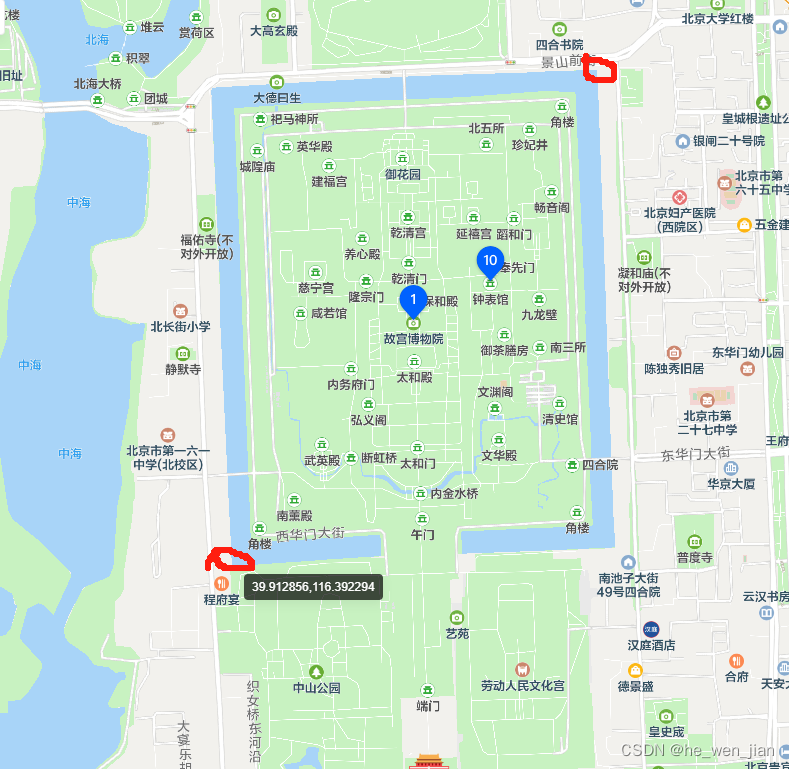
当前位置: 首页小程序正文 本文介绍: 指定可视范围的时候,只用include–points会很极限。导致marker不能完全显示。规划驾车线路的时候,使用uni的。 问题背景: 规划驾车线路的时候,使用uni的include-points指定可视范围的时候,会很极限。导致marker不能完全显示。 解决方法 给地图显示范围添加padding (推荐) <map id="myMap" :markers="markers" :polyline="polyline" :longitude="curLongitude" :latitude="curLatitude" @markertap="markertap" ></map> onLoad((e) => { uni.createMapContext('myMap', this).includePoints({ padding: [120, 110, 120, 110], points: [ { latitude: startCityLat.value, longitude: startCityLog.value }, { latitude: endCityLat.value, longitude: endCityLog.value } ] }); }); 或者获取并修改缩放地图(记得设置中心点) const appMapRef = ref(''); appMapRef.value = uni.createMapContext('myMap'); appMapRef.value.getScale({ success: (res) => { console.log('缩放', res); mapScale.value = res.scale - 1; console.log('mapScale.value', mapScale.value); } }); uni文档:点击这里 1的效果图: 原文地址:https://blog.csdn.net/qq_42866164/article/details/134593621 本文来自互联网用户投稿,该文观点仅代表作者本人,不代表本站立场。本站仅提供信息存储空间服务,不拥有所有权,不承担相关法律责任。 如若转载,请注明出处:http://www.7code.cn/show_20960.html 如若内容造成侵权/违法违规/事实不符,请联系代码007邮箱:suwngjj01@126.com进行投诉反馈,一经查实,立即删除! 主题授权提示:请在后台主题设置-主题授权-激活主题的正版授权,授权购买:RiTheme官网显示所有内容声明:本站所有文章,如无特殊说明或标注,均为本站原创发布。任何个人或组织,在未征得本站同意时,禁止复制、盗用、采集、发布本站内容到任何网站、书籍等各类媒体平台。如若本站内容侵犯了原著者的合法权益,可联系我们进行处理。mappaddinguni 代码007普通 打赏 收藏 海报 链接